 Austin Community College Geographic Information Systems (GIS) students are learning how to create detailed maps using drone technology.
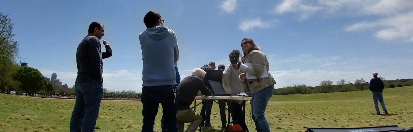
Students tested their skills at Zilker Park with a mapping drone called the Robota Eclipse UAV (unmanned aerial vehicle). Led by ACC instructors and an FAA-certified remote pilot, the students learned to plan, fly, and recover the drone. The drone comes equipped with a camera that can map about 400 acres for every 50-minute flight.
“This is leading-edge technology,” says Sean Moran, GIS department chair. “Students are exposed to the entire spectrum of GIS — from capturing images, to analyzing and processing, and then constructing high resolution basemaps.”
GIS technicians and analysts assist scientists, technologists, and related professionals in building, maintaining, modifying, or using GIS databases. GIS technicians and analysts typically earn more than $41 per hour in Central Texas.
The ACC GIS Program includes two certificates and an associate degree. For more information, visit austincc.edu/accgis or contact Moran at 512-223-4944 or [email protected].
Read more and view photos at the ACC GIS blog.
Tags: drone, GIS, mapping, Sean Moran, technology
Back to Top